
28
AprSurvey-Grade senseFly Drone the Focus of Airware Partnership
- Apr 28, 2017
- By Survey Pro

Partnership combines aerial platform with cloud-based intelligence
Airware, which provides end-to-end data solutions, has signed a global distribution agreement with senseFly to bring the survey-grade eBee Plus to its enterprise customers.
“By combining senseFly’s globally-proven, large-coverage eBee Plus platform with Airware’s unique cloud-based business intelligence, we are creating a truly enterprise-ready solution; a solution that enables customers to safely collect, and act upon, the geospatial data they need, for example when planning operations, calculating extraction volumes and monitoring a site’s evolution over time,” says Jean-Christophe Zufferey, senseFly’s CEO.
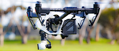
Airware’s end-to-end solutions for mining, quarrying, and construction sites harness drone technology to capture aerial data and translate it into measurable business impact for Fortune 500 companies around the world. As a result of this commercial partnership, the eBee Plus is now offered as part of Airware’s enterprise offering, which includes cloud-based data processing, analytics and reporting, as well as the training, support and professional services enterprises need to deploy drones at scale.
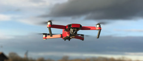
senseFly’s lightweight eBee Plus mapping drone features built-in RTK/PPK functionality, for survey-grade precision, and can document 220 ha (540 ac) in a single 59-minute flight (122 m / 400 ft AGL).
“To take full advantage of aerial data, surveyors demand that their tools provide survey-grade accuracy, efficiency and flexibility. The eBee Plus more than meets these requirements,” says Jonathan Downey, the founder and CEO of Airware. “Pairing the eBee Plus’ aerial efficiency and photogrammetric accuracy with our powerful enterprise-grade workflow enables companies to ensure compliance, enhance worker safety, and capture more accurate, repeatable data to improve decision-making.”
Airware will distribute senseFly’s eBee Plus across the globe as part of their enterprise solution offering. The solution is available within the global Cat dealers network as elements of the Cat Connect offering, which focuses on improving site and operation efficiency through a suite of industry specific products and services. As a result, Cat dealers will be able to offer their customers enterprise drone solutions that combine senseFly’s automated data collection with Airware’s enterprise-focused workflow, professional services, training, and cloud-based analytics that turn aerial data into business intelligence.
About senseFly
senseFly develops and produces aerial imaging drones for professional applications. The automated data collection tools are employed by customers around the world in fields such as surveying, agriculture, GIS, industrial inspection, mining and humanitarian aid. senseFly was founded in 2009 by a team of robotics researchers is now a specialist in professional mapping drones.
author
Search
Custom Menu
Recent Post
Monitoring Mini Prism (L-Ba...
Jan 11, 2019
Leica iCON: Status Bar Basics
Jul 12, 2017
How to Use Surveying Equipm...
May 05, 2017Archive
- January 2019
- July 2017
- April 2017
Stuart Smith
But I must explain to you how all this mistaken idea of denouncing sure and ising pain borand I will give you a complete account