
How to Use Surveying Equipment to Determine Land Boundaries
Surveying is the technique, profession, and science of determining the dimensions and contour of the Earth's surface. Using specialized surveying equipment, professional surveyors determine land boundaries for a variety of important reasons. One of the most common reasons for a consumer to acquire the assistance of a surveyor is the acquisition of a new piece of land, as it has to be legally determined where one person's property ends and another begins for government issued deeds. Additionally, surveyors work with cartographers to create accurate maps.
Surveying has existed in one form or another for at least 5,000 years; virtually all of recorded human history and likely even beyond. The pyramids in Egypt and Stonehenge in England are believed to have been created with the assistance of an ancient surveyor. It is an essential element of civilized society. Working with a combination of skills derived from physics, engineering, law, and the mathematics, surveyors are well trained to accurately measure flat and three-dimensional points, as well as the distance and angles between them.
Surveying Tools
Surveying requires data from three primary components. This includes the measurement of distance, angles, and elevation. There are several different types of survey tools but each tool is capable of providing the necessary data from one or more of the measurement types.
The art of surveying remained relatively unchanged until the late 1990s. Since the advent of more technologically advanced survey equipment, such as global positioning systems and electronic measurement devices, the tools available to the surveyor have become greater and more enhanced. As a result, some of the older techniques, such as the use of chains and tape are falling out of favor.
Rods
Surveying rods are a popular piece of equipment for surveyors and contractors alike. They are commonly made out of aluminum or hardwood, with both options having pros and cons. Though there are several different types or rod, they all serve the same purpose. Rods are designed to measure the distance between two points, often in conjunction with other surveying tools. The survey rod is often held by one surveyor or an assistant, as the other surveyor takes initial measurements, using one or more type of measurement device. There are several different types of rod.
Type of Rod |
Description |
|---|---|
|
Level Rod |
Leveling rods are typically made from aluminum or hardwood; they must always be treated with care since small chips can lead to level reading errors |
|
Philadelphia Level Rod |
Features two sliding sections joined by a brass sleeve; can be used for measurements of to 13 feet; can be read with a level from a distance of up to 250 feet |
|
San Francisco Level Rod |
Similar to the Philadelphia rod; features three separate, sliding sections for extending or reducing length |
|
Direct Reading Rod |
Read directly through a telescope by the surveyor; also known as self-reading rods |
|
Direct Elevation Rod |
Has a graduated strip that revolves around the rod using rollers; features numbers in reverse order; capable of providing elevation readings without need for additional foresight and backsight calculations |
|
Target Rod |
Features a target, making it possible for the person holding the rod to double check the readings presented by the person handling them surveying instrument |
Rods are a common survey tool used to estimate distance. Though very important, rods are only one of the numerous tools used to take survey measurements.
Tripods
A necessary tool for any surveyor, the tripod provides a strong, balanced location on which to place certain types of survey tools. Tripods are commonly adjustable and may be made up of wood, aluminum, or fiberglass. Though fiberglass makes a heavy load for toting from one job to another, aluminum and wood may swell or contract in certain weather conditions, slightly altering readings.
Tripods come in two primary sizes, though they are adjustable. There are also tripod extensions available to add extra reach to older or smaller models. The tripod will typically feature either a flat or dome head. Tripods are a commonly recognized tool of surveying, as most surveyors spend a lot of time behind the tripod, glancing through various measurement tools to acquire their all-important measurements.
Levels
Levels are another common tool of the survey trade. Often used in conjunction with a sturdy tripod and various rods, the tool is typically just a level attached to a sort of telescope or laser. The telescope is used to extend sight line in all directions, offering a reference point from which to measure the various elevations. Just as there are multiple types of surveying rods, multiple styles of level exist.
Hand Level
The hand level features a metal sighting tube with an attached bubble tube on the top. The bubble tube is reflected with a prism inside the tube so that the surveyor can see the bubble and terrain at the same time; used for taping and rough determinations of elevation.
Abney Level
The abney level functions as a type of hand level, but allows for rough estimates of vertical angles and slopes. Abney levels consist of a spirit level and sighting tube and are almost exclusively used by surveyors.
Automatic Level
The automatic level is a very common type of level for surveyors to use. It features a quick setup with a three-screw leveling head and can typically be identified by the bubble marked with a bullseye. To use the automatic level, the surveyor manually centers the bullseye bubble and from that point, a laser takes over to insure that the object remains level.
Electronic or Laser Level
An electronic or laser level transmits a visible laser beam or invisible infrared beam. These levels may feature either a single or rotating beam and are considered to be precise up to 1,000 feet. Common uses of the electronic or laser level include grading, excavating, and checking the depth of trenches.
A professional surveyor may find use for several different types of levels, depending on the assignment. The most commonly used today are the automatic level and the electronic level. These advanced levels can be used for nearly any surveying task.
Laser Detector
Laser detectors are needed when a laser level does not feature a beam that is visible to the human eye. The laser detector is attached to the rod, whether mounted or hand-held, and will move up and down in response to the laser beam. This gives the surveyor a clear idea of where the level beam is landing so that he or she may take accurate measurements
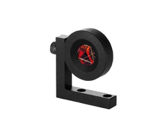
Double Pentagonal Prism
Often during construction work or surveying the surveyor needs to find a 90 degrees angle simply and effectively. The double pentagonal prism is a handheld device for locating these right triangles. The device features two prisms, of 90 and 180 degrees. The dual prisms allow for a wide field of sight, making it easy for a surveyor to locate measure cross sections and slopes with ease.
Range Poles
Range poles are a very common tool in the surveying world. They are used for sighting and marking ground points and lining up surveyors. Most range poles are six to ten feet in length and painted with alternating red and white stripes for easy sight. These poles may be made from fiberglass, wood, or metal
Plumb Bobs
Made of brass and weighing 6 to 18 ounces, plumb bobs are frequently used in conjunction with a double pentagonal prism. The plumb bob is attached to the bottom of a string coming from the double prism, in order to mark exactly where a perpendicular is needed along a centerline.
Gammon Reel
Gammon reel is commonly used to place and adjust plumb bobs. It may also be used as a target when taping. In general, a gammon reel is little more than a strong reel of line that can be adjusted to account for various terrains when taking measurements using a plumb bob and double prism.
Theodolites
Theodolites are primarily used to measure horizontal and vertical angles though they can also be used to determine horizontal distances and elevations. Theodolites are primarily used by professional surveyors, though they are sometimes used in other disciplines like metrology and rocket launch technology.
The theodolite features a movable telescope mounted between a horizontal and vertical axis. Theodolites that feature a telescope, which can be moved in a complete circle along a vertical plane are known as transit theodolites. Theodolites that feature a telescope that can only rotate in a semi-circle are known as non-transit theodolites.
Measuring Wheels
Measuring wheels are designed to be pushed along by surveyors to measure specific distances. They feature a counter on bottom that determines the distances based on number of rotations. Though simple in form, when properly calibrated measuring wheels can provide highly accurate readings.
Electronic Distance Measurer
An electronic distance measuring device detects the distance from one point to another based on the amount of time it takes a laser to travel from the measuring device to a prism. These advanced, but common pieces of surveying equipment have largely replaced chains as the standard for measuring distance.
Global Positioning System
The Global Positioning System or GPS may is one example of an electronic distances measurer. However, GPS does not work well with every terrain, as it is difficult to pick up the necessary satellite signals in heavily wooded or mountainous areas.
Total Station
The device known as the total station is one of the most advanced forms or surveying equipment available. An all-in-one device, the total station is a form of electronic distance measurer that is used to automatically measure both horizontal and vertical distances, as well as the angle of various slopes.
Conclusion
Surveyors measure distances in order to build level, sound buildings or determine the boundaries of a piece of land. This profession, typically held by individuals with a degree in civil engineering, is a very important one that has existed for all of recorded human history. Since distances can be distorted by hills and other factors, so the surveyor must use several unique tools to acquire precise measurements. The profession of surveying is commonly related to civil engineering, though surveying is an important part of many academic disciplines.
The art of surveying requires a good working knowledge of math, physics, engineering, and even law. The professional surveyor will be highly trained in his or her field, capable of performing a multitude of measurements, using the various tools and equipment listed throughout this buying guide. Surveyors have, and likely always will be, an important part of developing infrastructure and maintaining a civilized society.
Recent Post
Monitoring Mini Prism (L-Ba...
Jan 11, 2019
Leica iCON: Status Bar Basics
Jul 12, 2017
Stuart Smith
But I must explain to you how all this mistaken idea of denouncing sure and ising pain borand I will give you a complete account